In 1822, Richard Dough divided part of his world along a ditch. One side would belong to his son William Shepherd, who was to have the plantation where Richard lived. On the other lay the land left to Augustus Cabarrus Dough. The will followed old lines past land associated with James Thomas and Thomas Brown, toward neighboring holdings and land devised to his grandson Frederick. Out on Albemarle Sound, Richard had marshland to distribute as well. The document moved through a familiar neighborhood, turning its boundaries into the terms of an inheritance.1
The ditch is more certain than the house. No surviving evidence yet fixes Richard’s dwelling to a modern parcel. But his will gives the family a place in the southern Currituck mainland, and the deeds begin to explain how that place had been assembled. More than fifty years before the will, another record calls a Richard Dough of this neighborhood a boatsman. The early Powells Point landholder probably was the man who made the 1822 will—a Moderate confidence identification, supported by recurring land and family connections, though a complete chain of original deeds has not yet joined the two.2
That probable connection carries the story back from the dividing ditch to a peninsula surrounded by working water.
Between the river and the sound
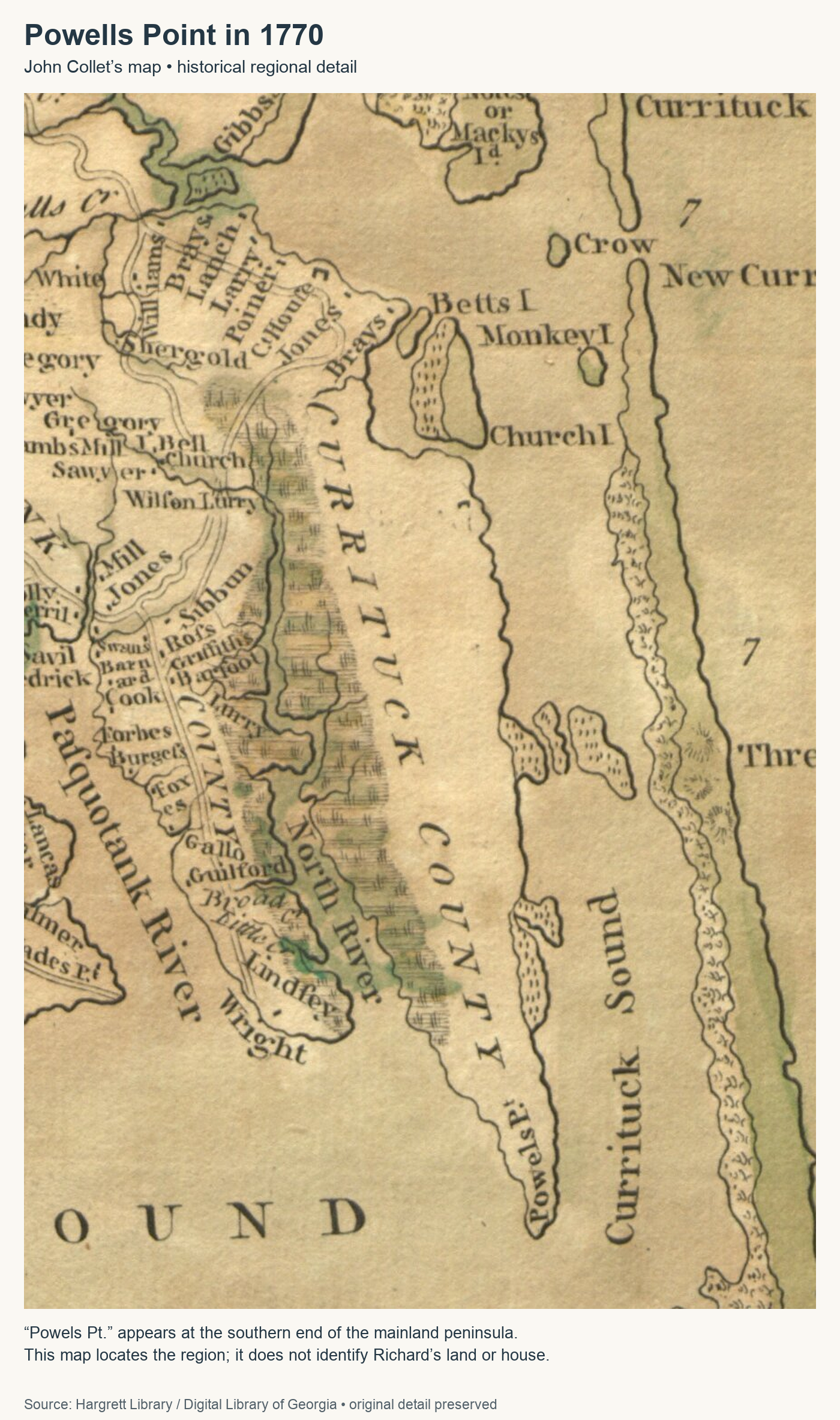
On John Collet’s 1770 map, “Powels Pt” lies at the lower end of the mainland between North River and Currituck Sound. The point looks toward Albemarle Sound. A modern traveler knows the southern tip as Point Harbor and encounters the Powells Point name farther north. The old name belonged to a geographic setting broader than a modern community marker. That distinction matters when following Richard’s deeds: a tract described at Powells Point need not lie beside today’s place-name label.3
Water connected these shores to a larger world, although the shallow sounds constrained the vessels that could use them. Writing in 1709, John Lawson described how produce could be carried in small craft to vessels near Currituck Inlet because shoals limited passage through the sound. His account predates Richard’s boatsman deed by more than sixty years. It explains the usefulness of small boats in this landscape; it does not supply Richard with a particular vessel, cargo or voyage.4
On 20 January 1769, Thomas Evans conveyed Richard fifteen acres for forty shillings proclamation money. The tract adjoined land Richard already owned. This was an addition to an existing holding, not his documented arrival in Currituck. Two years later, on 12 February 1771, Evans sold him another thirty-five acres for four pounds. In that deed, the clerk preserved the occupational word that otherwise might have disappeared from the family history: boatsman.2
The Revolution intervened between those purchases and the next substantial tract. In May 1776, North Carolina’s Provincial Congress authorized the appointment of commissioners at Currituck and other ports to take bonds and issue certificates to departing shipmasters. War brought new rules to the waterways. Richard’s personal allegiance and any military service remain unproved. It is the land records that carry his story through the war.5
On 22 March 1778, John and Rebecca Forbes, then of Camden County, sold Richard 193 acres at Pools Point, near where he lived and west of the main road. Richard was described as a Currituck resident. The sellers’ Camden address does not put his home across the county line. Nor does the deed’s later passage through court move the purchase to 1785: it was proved in March of that year and registered on 1 June, seven years after its execution.6
The next year’s tax assessment may give this landholder a measure of substance. The surviving transcription lists a Richard Dough with property valued at £2,178; his identification with the Powells Point man remains a candidate attribution. That was assessed value, not the amount of tax paid, and it cannot safely be translated into a modern cash fortune. If the identification is correct, it adds another dimension to the man called a boatsman. The name appears in records of land, neighbors and property as well as in the one occupational description.7
Land added a few acres at a time
Richard’s neighborhood emerges from small acquisitions as well as large ones. A 1797 abstract records twelve acres bought from Thomas Brown beside Richard’s own land and James Thomas’s. Frederick Dough witnessed the deed. In 1801, a transcription describes James Thomas, identified in the record as a free Black man, selling Richard Senior two and a quarter acres across the New Road. Another twenty-acre purchase from Thomas followed in 1805. These intermediate deeds have not all been checked against their register images, but their names and boundaries help connect the early holdings to the Thomas and Brown land remembered in the will.8
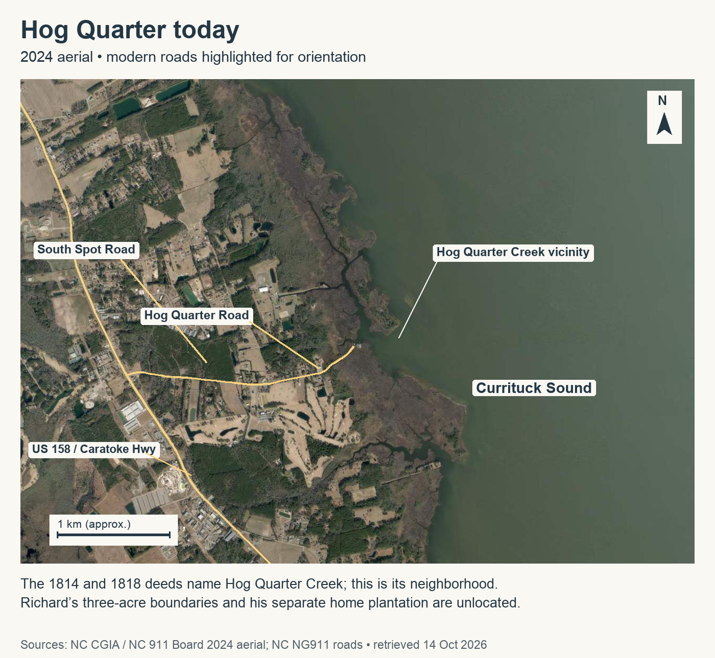
The property was not one uninterrupted plantation. On 12 March 1814, James Melson sold Richard a three-acre tract at Hog Quarter Creek for ten dollars. Richard conveyed three acres with the same distinctive boundary sequence to John Chaplin on 16 May 1818, for fourteen dollars. The matching descriptions give High confidence that these were the same small parcel. They do not identify it as Richard’s home.9
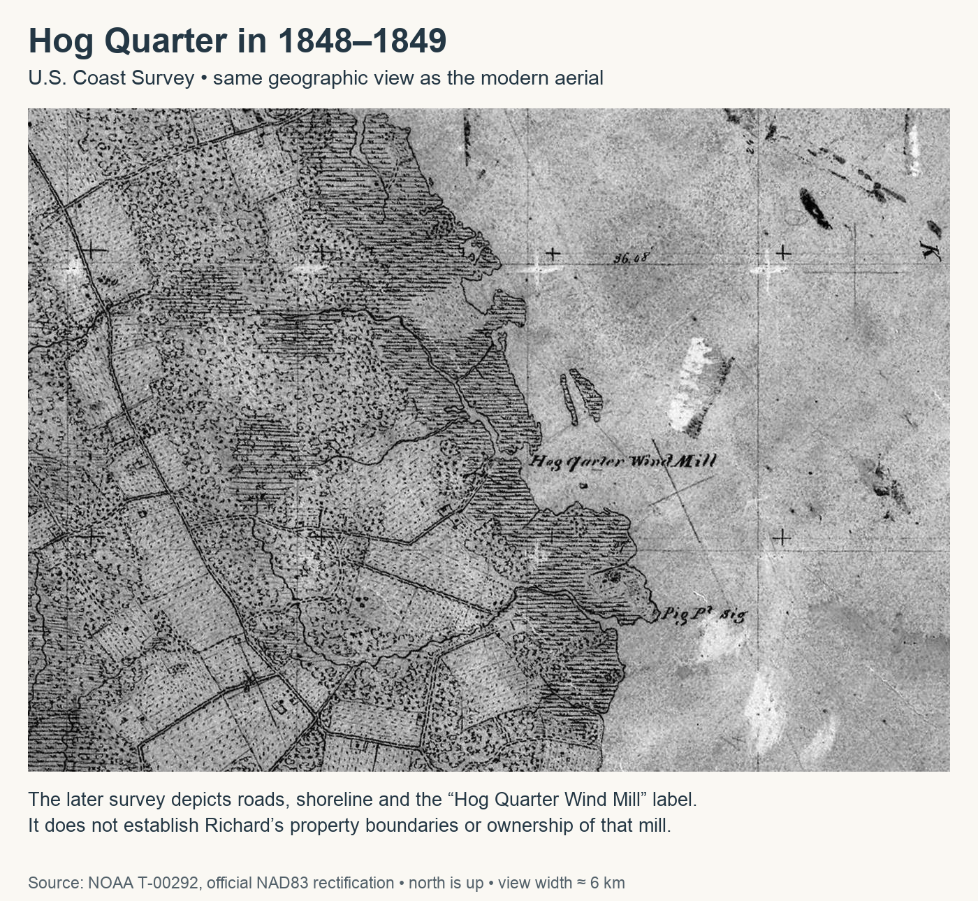
Hog Quarter Creek can be oriented on the Currituck Sound side of the mainland near modern Spot and Harbinger, east of U.S. 158. A Coast Survey made in 1848–49 gives a later view of that shore, including a windmill. It is useful for seeing a named creek within a changing landscape, but it was drawn decades after the sale. Neither the windmill nor its site has been shown to belong to Richard. His separate Albemarle Sound marsh must also remain separate from the creek tract.3
By the time Richard made his will, earlier transfers were part of the accounting. His son William had already bought land from him on favorable terms, and Richard counted that advantage toward William’s inheritance. An 1812 abstract of a fifty-acre conveyance to William, followed by William’s sale in 1818, is a strong candidate for that transaction. It belongs to the William who bought land. The other son named William, William Shepherd, was a different person, with a different provision still to come.110
What the will divided
Richard left his home plantation to William Shepherd and neighboring land to Augustus. His grandson Frederick received fifty acres. There were daughters and other grandchildren to provide for, earlier gifts to acknowledge, and a daughter, Mary, whose coming of age still lay ahead. The will distributes a family’s property across generations without giving us the wife’s name, Richard’s parents, or even a full date for the document. The year 1822 is written; the spaces for day and month were left blank.1
People held in slavery were included in those arrangements. Richard’s earlier gifts to his sons had already led to sales. On 8 January 1821, he conveyed George, described as about fourteen years old, to John C. Dough. Two days later, John C. sold George to Willis Gallop for $325. Both deeds survive in the county register, and the will recalls the same chain of ownership.11
Caleb’s earlier share included a girl named Lydia, along with a horse, bed and sow. Her gift deed, dated 15 March 1821, describes her as about eight years old. A second deed, bearing the same date, records Caleb’s sale of Lydia to Daniel Sanderson for $200. The matching name, age, date and parties give High confidence that this was the same child. The two instruments record a gift and a sale; they do not tell us where she was taken or whom she left behind.11
Another Lydia, a woman already in Elizabeth Etheridge’s possession, was named separately in Richard’s will, together with her “increase”—the record’s term for her descendants, who are not individually named in that clause. Matilda had been conveyed for Susanna Murrell’s benefit.1
The new bequests assigned the girl Polly and boy Lamb to Augustus; the man David and boy Tom to William Shepherd; and the man Daniel and boys Lewis and Sampson to Mary. The enslaved Polly was not Richard’s granddaughter of the same name. Nor should either enslaved Lydia be confused with Lydia Dough, another person mentioned in the will.1
Mary’s age affected Obed’s future. Richard directed how Obed was to be allocated if an enslaved person assigned to Augustus, William Shepherd or Mary died before Mary came of age. Otherwise the three children were to share him, with provisions for the associated expenses and profits. This was a contingency written into the will, not evidence that it occurred. The same children were jointly assigned Cate and an older woman whose name is read as Chain, with the spelling qualified.1
Another document reveals a mother and child whose lives had already been drawn into Richard’s family arrangements. On 21 August 1806, a Richard Dough gave his daughter Sally Lindsey the lifetime use of Rachel and Rachel’s child, whose name is read as Clarisey. After Sally’s death, that interest was to pass to Richard’s grandsons William and John Lindsey. The same-day constable-sale transcription reports that Richard had purchased Rachel and the child from William Lindsey Senior’s estate. The will’s later naming of a grandson John Lindsey supports a Moderate confidence identification of this Richard with the 1822 testator.12
Rachel and her child appear together in the deed, but the document does not follow them beyond its terms. Their mother-and-child relationship is explicit; the circumstances of their later lives are not. In the family’s papers, people whose own voices have not survived are visible at moments when others asserted control over their labor, their children and their future.
The ditch after Richard
Richard had died by February Term 1825, when his will was proved. Its registration on 7 July was a later act of recordkeeping. The exact date of his death remains unknown.1
Within a few years, ownership of the land left to Augustus was changing through sales of undivided shares. On 26 March 1828, Elizabeth Etheridge sold Jacob Aydelott her inherited, undivided share for thirty-three dollars. Caleb Dough Senior sold his share for twenty-five dollars on 21 May. These were sales of interests in a larger property, not sales of the entire hundred-acre tract for those sums. A separate marsh on Albemarle Sound accompanied the upland description.13
The bounds return to the ditch beside William S. Dough, the former James Thomas and Thomas Brown land, and Frederick’s heirs. That distinctive combination makes it highly likely that the deceased Augustus was Richard’s son Augustus Cabarrus. It also explains why an old ditch matters to a family history. A familiar name alone might belong to another person. A name joined to the same neighbors, inherited land and dividing line is much harder to mistake.13
The surviving copies do not agree in every detail. Where one deed runs northerly along Elizabeth Dough’s line, the other runs southerly. Those words cannot be reconciled by drawing a confident polygon on a modern map. The marsh, described as twelve and a half acres in the will, appears as twelve acres in the later conveyances. The family connection is stronger than the surviving evidence for an exact footprint.13
In January 1836, William S. Dough of Camden County sold Thomas Aydelott an estimated hundred acres inherited from his deceased father Richard. The deed names the father explicitly. The identification of this seller as William Shepherd is High confidence, supported by his name and the inheritance evidence. His Camden residence belongs to 1836; it need not be carried backward into Richard’s Currituck life.14
Richard’s house has not been recovered on the map. The surviving record is more particular in other ways: a fifteen-acre addition to land already held, three acres beside a creek, a daughter not yet of age, two sons named William, a mother and child named Rachel and Clarisey. The ditch used to divide his estate continued to describe it after his death. It still gives us a way into this family, provided we follow the line only as far as the evidence allows.
Family Ties
Richard’s birth date, parents, siblings and wife are unknown. The records do not establish an immigrant origin or connect him to a particular European family. The eight sons and daughters expressly named in his 1822 will are listed below. Birth and death dates remain unknown except where a qualified bound is given.1
William Dough — Son; distinct from William Shepherd. His earlier favorable land purchase counted toward his share.
John C. Dough — Son. The middle initial has not been securely expanded.
Caleb Dough — Son; an earlier gift counted toward his share.
Augustus Cabarrus Dough — Son. High confidence identification with the Augustus deceased by 26 March 1828; thus he died after the 1822 will and before that deed. An earlier death bound of 23 February 1828 is reported in a deed abstract.
William Shepherd Dough — Son, also called William S.; received the home plantation. High confidence identification with the 1836 seller whose deed expressly names father Richard. He was probably the later Camden farmer born about 1812, living in June 1880 and deceased by 2 January 1886. Those dates depend on a Moderate confidence (probable) identification; the four census ages suggest births ranging roughly from 1811 to 1815. His estate sale on 2 January 1886 establishes a latest death bound, not an exact death date.15
Elizabeth Etheridge — Daughter. High confidence identification with the 1828 seller of an Augustus inheritance share. Her husband’s name is not supplied by these records.
Susanna, or Susannah, Murrell — Daughter. A 14 April 1821 deed transcription calls her the wife of Nathan Murrell; its original locator still needs resolution.
Mary Dough — Daughter; the will anticipates her coming of age. No numerical birth estimate is adopted.
The will also identifies Frederick Dough as Richard’s grandson and as the son of a deceased Frederick Dough. The younger Frederick’s relationship to both men is Established. Placing the deceased Frederick as Richard’s own son is a High confidence inference; the will does not expressly call him “my son.” His death preceded the 1822 will.1
Other grandchildren named directly are John Lindsey, Benjamin McKinney, Polly, Ruth and Jasper Green. Benjamin’s surname also reads as McKimmey in the manuscript; McKinney is the normalized form used here. Their intervening parents are not identified. The will gives no surnames for Polly or Ruth; Jasper’s surname in the following clause must not be extended to them. All their birth and death dates are unknown.1
The 1806 deed explicitly calls Sally Lindsey the grantor Richard’s daughter and William and John Lindsey his grandsons. Those relationships are Established within that deed. Bringing Sally and William into the 1822 testator’s family depends on the Moderate confidence identification of the two Richards. The deed does not expressly call the boys Sally’s sons. Her absence, and William’s absence, from the later will do not establish that either had died.12
Finally, the will names Lydia Dough as a daughter of Sampson Dough. That relationship is Established. Neither person’s relationship to Richard has been established, so they are not attached to his tree.1
Between the Lines
Possibilities, not proven relationships.
The boatsman and the testator — Moderate confidence (probable). The case rests on more than a repeated name: the Powells Point locality, land beside earlier holdings, recurring Thomas, Brown and Evans associations, and the William and Frederick land references lead toward the will’s neighborhood. But several intermediate deeds survive in this investigation only as abstracts, and two distinct Richard households appear in the 1790 census. Checking the full original title sequence—especially the 1797, 1801, 1805 and 1812 deeds—could strengthen the connection or expose a second man within the apparent chain.281016
The Lindsey family — Moderate confidence (probable). The shared grandson John Lindsey provides a discriminating link between the 1806 grantor and 1822 testator. Sally and William’s omission from the will leaves an incomplete family picture, not a contradiction or proof of death. Lindsey estate papers and receipts from Richard’s estate may explain how these branches fit.12
Deceased Frederick’s place — High confidence (very likely). Richard’s express grandson was the son of a deceased man who also bore the Dough surname. The land and family context support placing the elder Frederick as Richard’s son. A maternal connection is not expressly excluded by the will’s wording. Frederick’s own estate or a deed stating the relationship would settle the intervening link.1
The granddaughters without surnames — Unknown. A Polly Green sold an inherited Augustus share in 1829. She is a possible match for Richard’s granddaughter Polly, but that identification is not established. The will itself leaves both Polly’s and Ruth’s surnames unstated. The original inheritance deed and a documented chain of entitlement are the next tests; Jasper Green’s nearby bequest is not enough.17
William Shepherd in Camden — Moderate confidence (probable). The 1836 seller lived in Camden, and the later farmer was recorded with a Currituck birthplace in 1850 and as Shepard Dowe in 1860. His age fits the younger generation in Richard’s will. The 1860 census instead gives Camden as his birthplace, and the land and household sequence between 1836 and 1850 remains incomplete. Original guardianship papers and the intervening deeds could test the identification; Richard’s other son William remains distinct.1415
A Life in the Records
This is the currently identified record inventory, not an exhaustive list of everything that survives. A dated record may be secure while the identity of its Richard remains uncertain. Register image means an image of the county’s manuscript book, which may itself be a clerk’s copy. Abstract or transcription identifies derivative text. Later proof and registration dates do not by themselves show that Richard appeared in court or was still living.
The will and the estate: securely dated records
| Date | Record and significance |
|---|---|
| 1822; day and month blank | Richard executes his will: eight explicit children, six named grandchildren and the provisions described above. Currituck Will Book 3:186–188; register images.1 |
| February Term 1825; registered 7 July 1825 | Will proved, then entered in the register. Richard was dead by probate; July is not his death date.1 |
| 23 February 1828; proved February Term; registered 23 June 1828 | A 53-acre conveyance at Powells Point surrounding a Baptist meetinghouse begins at a marked pine also at the corner of Richard’s deceased land. It does not establish his church membership or identify a modern church site. Deed Book 18:75b–76; register images.18 |
| 26 March 1828; proved May Term; registered 18 January 1829 | Elizabeth Etheridge sells her undivided Augustus inheritance share: the hundred-acre tract beside the dividing ditch and a separate twelve-acre marsh. Deed Book 18:151; register image. Identity with Richard’s daughter and son: High confidence.13 |
| 21 May 1828; proved May Term; registered 18 January 1829 | Caleb Dough Senior sells his inherited land share; the corresponding boundary direction differs from Elizabeth’s deed. Deed Book 18:153; register image.13 |
| 11 January 1836; proved May Term; registered 25 June 1836 | William S. Dough, then of Camden, sells land inherited from his father Richard. Deed Book 21:233; register image. Identity with William Shepherd: High confidence.14 |
Earlier appearances and later references: attribution and source limits
The early Powells Point sequence probably concerns the testator, at Moderate confidence. Entries outside that sequence remain individually qualified. Deed-book references below are Currituck County; the selected published abstracts are linked in the sources.17
| Event date; later recordkeeping | Appearance and source status |
|---|---|
| 20 January 1769 | Fifteen-acre Powells Point purchase beside Richard’s own land. DB2:124–125; register images.2 |
| 1769, exact day/month disputed | Boundary reference to Richard Doos/Does; surname reading also qualified. DB2:93–94; partly read register images.19 |
| 12 February 1771 | Thirty-five-acre purchase calls Richard a boatsman, DB2:344, register image; same-day witness appearance in another deed, DB2:338, abstract.2 |
| 25 September 1771; March 1772/1772 later dates | Neighbor and witness in an Evans–Hill deed; the roles of the later dates remain unsettled. Published Brayton abstract, printed p.80.20 |
| 22 March 1778; proved March Term 1785; registered 1 June 1785 | Purchase of 193 acres near his residence. DB5:52; register image.6 |
| 1779 tax year; examined 18 March 1780 | Assessed property value £2,178; transcription of assessment, original uninspected.7 |
| 13 March 1780; registered September 1783 | Witness to a 351-acre Poplar Branch deed. DB4:111; abstract, identity uncertain. |
| 21 March 1781; registered 26 February 1782 | Richard Daugh conveys fifty acres at Powells Point to Caleb Chaplin. DB4:2–3; abstract. |
| 1783 | Guardian-list entry; index only, underlying role and record unresolved.20 |
| 8 June 1784; registered 6 and 8 August 1784 | Witness to two Light Swamp deeds, fifty and 130 acres. DB4:232–234; abstracts, identity unresolved. |
| 5 March 1785; registered 24 May 1785 | Neighbor in a 64-acre conveyance. DB5:32; abstract. |
| 6 April 1787; registered 28 July 1787 | Richard’s fence and land bound a seventy-acre conveyance. DB5:249–250; abstract. |
| 18 April 1789; affidavit 19 April; June Term 1789 | Executor named in Caleb Chaplin’s will; Sarah Dough a witness. WB1:239; transcription. Sarah’s relationship to Richard is unknown.21 |
| 30 May 1789; registered 13 August 1789 | Witness to a twenty-five-acre Powells Point deed. DB6:34; abstract. |
| 1790 | Separate Richard Dough and Richard Dauge census households contain seventeen and six people. Neither has been conclusively assigned to the testator; manuscript reproductions reviewed previously.16 |
| 4 June 1792; registered 25 September 1792 | Boundary reference in a fifty-acre deed. DB6:242; abstract. |
| 26 April 1793; registered 25 September 1794 | Boundary reference in an eight-acre deed. DB7:91; abstract. |
| 8 October 1793; registered 25 March 1794 | Boundary reference in a twelve-acre deed; Ann Dough witnesses. Her relationship is unknown. DB7:27; abstract. |
| 7 December 1793; registered 25 September 1794 | Richard and the main road bound eighty acres. DB7:90; abstract. |
| 2 November 1795; registered 11 January 1796 | Repeated Richard/main-road bounds in an eighty-acre deed. DB7:229; abstract. |
| 17 November 1796; registered 30 September 1797 | Boundary reference in an eighty-acre conveyance. DB8:13; abstract. |
| 19 June 1797; registered 31 March 1798 | Thomas Brown sells Richard twelve acres beside his own land and James Thomas’s; Frederick witnesses. DB8:60; abstract.8 |
| Court session, 24–28 February 1800 | Richard Senior appointed to an estate-account committee; copied minutes, p.16, original uninspected.20 |
| 1800 | Candidate census household includes seven enslaved people. A disputed female age-column entry prevents a secure household total; no wife or exact birth year assigned.16 |
| 25 June 1801; proved August Term 1801 | James Thomas, described as a free Black man, sells Richard Senior two and a quarter acres across New Road. DB3:180–181; transcription.8 |
| 3 September 1805; registered 7 April 1806 | Twenty-acre Powells Point purchase from Thomas. DB9:162–163; abstract.8 |
| 21 August 1806; acknowledged August Term; registered 24 October 1806 | Constable sale of Rachel and Clarisey from William Lindsey Senior’s estate to Richard Senior. DB9:227; transcription.12 |
| 21 August 1806; proved February Term 1807; registered 2 April 1807 | Lifetime-use gift to daughter Sally, remainder to grandsons William and John Lindsey. DB9:262; register image; Moderate confidence grantor identification.12 |
| 19 January 1807; receipt same day | Purchase of twenty-seven acres of Albemarle Sound marsh. DB9:257; transcription. It is not equated with the will’s marsh by acreage alone. |
| 1 January 1810; registered 18 April 1810 | Chancery-sale recital names Richard among guardians of Gregory heirs. DB10:124–125; abstract with a Caleb Gregory/Etheridge name inconsistency; identity unresolved. |
| 9 February 1811; registered 27 November 1811 | Neighbor in a hundred-acre conveyance. DB11:209–210; abstract. |
| 16 March 1811; registered 28 July 1814 | Neighbor in a twelve-acre conveyance. DB12:231; abstract. |
| 6 January 1812; registered 22 August 1812 | Richard conveys fifty acres to William; Frederick’s occupied land is among the bounds. DB11:313; abstract, no express sonship in the deed.10 |
| 12 March 1814; registered 16 November 1814 | Three-acre Hog Quarter Creek purchase for ten dollars. DB12:358; register image.9 |
| 22 February 1817; registered 4 May 1817 | Boundary reference in a thirty-acre deed. DB14:130–131; abstract. |
| 13 February 1818; registered 10 April 1818 | Richard and the main road bound twenty-five acres. DB14:290; abstract. |
| 16 May 1818; proved August Term; registered 10 October 1818 | Three-acre Hog Quarter Creek sale for fourteen dollars. DB14:360; register image; High confidence match to the 1814 parcel.9 |
| Writs, 26 June 1818; recorded 25 July 1820 | Sheriff’s sale of Thomas Brown land refers to John C. and Richard’s fence. DB15:72–73; abstract. Recording date alone does not establish Richard’s survival. |
| 26 September 1818; registered 26 January 1819 | William sells fifty acres with the 1812 bounds. DB14:405–406; abstract; strong forward-title candidate.10 |
| 12 October 1818; registered 20 November 1820 | Boundary reference in a seventy-acre deed. DB15:136; abstract. |
| 8 January 1821; registered 20 June 1821 | Richard conveys George, about fourteen, to son John C. DB15:270–271; newly inspected register images.11 |
| 10 January 1821; proved February Term; registered 11 May 1821 | John C. sells George, about fourteen, to Willis Gallop for $325. DB15:221–222; newly inspected register images. The will corroborates the transfer chain; the later registration of the gift does not reverse the execution order.11 |
| 15 March 1821; gift proved August Term (year not visible), registered 4 January 1822; sale proved August Term 1821, registered 6 February 1822 | Two same-date instruments record Richard giving Lydia, about eight, to son Caleb and Caleb selling her to Daniel Sanderson for $200. DB15:288 and299; newly inspected register images. Same child: High confidence.11 |
| 14 April 1821; proved May Term 1822; registered 11 January 1823 | Matilda conveyed for daughter Susannah, wife of Nathan Murrell. Transcription; original book/page unresolved. |
| 23 February 1828; registered 12 August 1828 | John C. sells inherited Augustus shares in land and enslaved people. DB18:104–105; abstracts. |
| 21 May 1828 | Caleb’s separate sale of an inherited interest in enslaved people. DB18:152; abstract, distinct from the land deed on p.153. |
| 19 February 1829; registered 19 May 1829 | Seventy-acre deed names Richard’s heirs among its bounds. DB18:260–261; abstract. |
| 1 March 1829; registered 28 November 1829 | Polly Green sells an Augustus inheritance share. DB18:352; abstract; identity with Richard’s granddaughter unproved. |
| May 1829; day reported as 20 or 26 | Caleb Forbes appointed guardian of Shepard and Mary, children/orphans of Richard. Published abstracts disagree on the day; original uninspected.22 |
| 1 July 1829; registered 7 August 1830 | Elizabeth Chaplin and Susan Dough sell an Augustus inheritance share. DB18:427; abstract; their relationships to Richard unresolved. |
| 30 November 1829; registered 15 April 1830 | Sale by Whitehall executors describes Richard’s deceased tract as a boundary. DB18:383; abstract, later reference only. |
| 28 February 1831 | Jacob Aydelott appointed guardian of Shepard and Mary. Published abstract; original uninspected.22 |
Namesakes, disputed dates and unverified leads
These references are retained to show what has been considered; they are not added to Richard’s established life.1720
| Date or claim | Why it remains separate |
|---|---|
| 1715/16 and 1746 | Earlier Richard/Jane and Tull records have no established bridge to the testator. |
| 20 March 1787; registered 23 July 1787 | Richard Dauge witnesses a deed, DB5:241–242; identity unassigned. |
| 1787 will; 12 November 1788 sale, registered 7 August 1790 | Benjamin’s will, WB1:230, and Richard/Rachel’s sale, DB6:88–89, belong to a northern Currituck/Tulls Creek family cluster; not merged here. |
| 21 June 1788 | Princess Anne marriage bond for Richard Douge Junior and Anna Pearcy; published abstract with no established connection to this Richard. |
| 13 December 1788; registered 9 November 1789 | Elias/Mary deed, DB6:45, retained with the separate northern cluster. |
| 30 May 1792; registered 5 July 1792 | Tulls Creek transaction, DB6:232–233; separate cluster. |
| 26 December 1792; registered 28 March 1793 | Richard Dauge witnesses the Betsey Barret maintenance deed, DB6:260; identity unassigned. |
| 11 March 1796 | Mulder deed copied in DB7:334–335 and DB3:123; one underlying deed, not two appearances, retained with the northern cluster. |
| 8 January 1800; recital 25 February 1801 | Richard/Dinah/William Lufman transaction, DB8:197 and DB3:129–130; another unresolved cluster. |
| 22 December 1812; registered 3 April 1813 | Ten-acre Etheridge conveyance, DB12:117; not assigned automatically to Powells Point Richard. |
| Reported birth in 1748; father’s alleged death in 1803; immigrant or Huguenot ancestry; Sarah as wife; Revolutionary service | Unsupported or unresolved claims. None supplies an established date, parent, spouse, origin or military career for the article’s subject. |
No undated original record in the present inventory independently adds an event to this Richard’s life. Several family charts and reported claims lack adequate source identification; they are not treated as a second chronology.
The Family as We Currently Understand It

The tree distinguishes a relationship stated in a record from the identification of people across records. Solid connectors show Established relationships; long-dashed connectors identify supported inferences at their stated confidence. A grandchild’s unknown parent is left unknown. The close-family view does not extend Richard’s line through later generations.
Sources
The article uses county register images where inspected, alongside clearly labeled published abstracts, transcriptions and indexes. Copies of the same deed or will are one source, not independent corroboration. The research record and source catalog retain the local captures, image locators, reading disputes and review history.
- Richard Dough will, execution year 1822 (month and day blank), proved February Term 1825, registered 7 July 1825, Currituck County, North Carolina, Will Book 3:186–188. Clerk’s register images, FamilySearch DGS4754832, current viewer image102, pp.186–187 and image103, pp.188–189; image numbers in older saved filenames differ. Three-page copies in the Dough family collection and newly recovered register pages were separately read for this article. The improved page supports reading the older woman’s name as Chain, with spelling qualified, superseding an earlier Chloe possibility; these are alternative readings for one woman. ↩1 ↩2 ↩3 ↩4 ↩5 ↩6 ↩7 ↩8 ↩9 ↩10 ↩11 ↩12 ↩13 ↩14
- Thomas Evans (also Evens) to Richard Dough, 20 January 1769, Currituck Deed Book 2:124–125, DGS 7513405, images 344–345, opening; Evans to Richard, 12 February 1771, DB2:344, image 504, register image. The early-landholder/testator identification also depends on the intermediate deeds and the will, not on these two instruments alone. ↩1 ↩2 ↩3 ↩4 ↩5
- John Collet, map of North Carolina, 1770; U.S. Coast Survey, survey T00292, 1848–49; modern geographic orientation from the accompanying map sources. Collet map, published 1 May 1770, Hargrett Library/Digital Library of Georgia catalog; U.S. Coast Survey T-00292, 1848–1849, NOAA original and official rectified package; NC CGIA/NC 911 Board orthophotography, 2024 imagery retrieved 14 October 2026, with official road geometry. Historical and modern Hog Quarter figures show the same extent; the map labels and source strips are modern additions outside the historical image. The maps establish orientation, not Richard’s house or deed boundaries. ↩1 ↩2
- John Lawson, A New Voyage to Carolina (London, 1709), “Of the Inlets and Havens of this Country,” pp.64–65; inspected as a transcription excerpt in the State Library of North Carolina’s ANCHOR resource. Lawson’s depths and transport description belong to his own time. ↩
- Journal of the North Carolina Provincial Congress, 11 May 1776, in Naval Documents of the American Revolution, vol.5, p.58, published transcription. The displayed source note identifies North Carolina Secretary of State papers; no Richard Dough is named. ↩
- John and Rebecca Forbes to Richard Dough, 22 March 1778, proved March Term 1785, registered 1 June 1785, Currituck DB5:52, DGS 7513407, image 335, register image. ↩1 ↩2
- Currituck 1779 assessment, examined 18 March 1780, Marty Holland transcription, citing North Carolina Archives, General Assembly Papers L.P.30.1. The underlying manuscript has not been inspected in this investigation. The amount is a property valuation. ↩1 ↩2
- Currituck DB8:60, Thomas Brown to Richard Dauge, 19 June 1797, registered 31 March 1798; DB3:180–181, James Thomas to Richard Senior, 25 June 1801, proved August Term 1801; DB9:162–163, Thomas to Richard Senior, 3 September 1805, registered 7 April 1806. Modern abstracts/transcriptions: DB8, DB3, DB9. These are pending original-image verification. ↩1 ↩2 ↩3 ↩4 ↩5
- James Melson to Richard Dough, 12 March 1814, registered 16 November 1814, Currituck DB12:358, DGS 7513634, image 350, register image; Richard to John Chaplin, 16 May 1818, proved August Term, registered 10 October 1818, DB14:360, DGS 7513635, image 290, register image. The full boundary sequences were independently compared in the October research. ↩1 ↩2 ↩3
- Richard to William Dough, 6 January 1812, registered 22 August 1812, DB11:313, abstract; William to Gallop, 26 September 1818, registered 26 January 1819, DB14:405–406, abstract; compare Richard’s 1822 will. The deed does not expressly call William a son. ↩1 ↩2 ↩3 ↩4
- Currituck Deed Book15:270–271, Richard Dough to son John C. Dough, 8 January 1821, registered 20 June 1821, George aged fourteen or thereabouts; DB15:221–222, John C. Dough to Willis Gallop, 10 January 1821, $325, proved February Term1821, registered11 May1821; DB15:288, Richard to son Caleb, 15 March1821, Lydia aged eight or thereabouts, proved August Term (year not visible), registered4 January1822; DB15:299, Caleb to Daniel Sanderson, same execution date and approximate age, $200, proved August Term1821, registered6 February1822. Newly recovered register images independently read16 November2026. Register images: George gift p.270 and p.271; George sale p.221 and p.222; Lydia gift p.288 and sale p.299. The final digit of the gift year is obscured by the gutter, read as 182[1]; the sale clearly reads 1821. The George gift proof month remains uncertain under bleedthrough. ↩1 ↩2 ↩3 ↩4 ↩5
- Richard Dough to Sally Lindsey, with remainder to grandsons William and John Lindsey, 21 August 1806, proved February Term 1807, registered 2 April 1807, Currituck DB9:262, DGS 7513409, image 544, register image. Same-day constable sale, DB9:227, acknowledged August Term, registered 24 October 1806, transcription. The child’s name is read as Clarisey, with spelling qualified. ↩1 ↩2 ↩3 ↩4 ↩5
- Elizabeth Etheridge to Jacob Aydelott, 26 March 1828, Currituck DB18:151, DGS 7513638, image 157, register image; Caleb Dough Senior to Jacob Aydelott, 21 May 1828, DB18:153, image 159, register image. Both proved May Term 1828 and registered 18 January 1829. Original register pages recovered and separately reviewed 16 November 2026. Retain the northerly/southerly boundary variant. John C.’s earlier transaction, 23 February 1828, DB18:104–105, remains an abstract. ↩1 ↩2 ↩3 ↩4 ↩5
- William S. Dough of Camden County to Thomas Aydelott, 11 January 1836, proved May Term, registered 25 June 1836, Currituck DB21:233, DGS 7513641, image 258, register image. ↩1 ↩2 ↩3
- Original-record images in the Forehand research collection: 1850 U.S. census, Camden County, dwelling/family 198/198, lines 20–26 (age 35); 1860, Camden County, p. 56, household 520/520, lines 28–35 (age 47); 1870, Shiloh Township, p. 21, dwelling/family 182/186, lines 29–37 (age 58); 1880, Shiloh Township, ED 17, p. 35, dwelling/family 350/353 (age 68). The 1880 census refers to 1 June; the page was enumerated 26 June. Camden estate of Wm. S. Dough Sen., account of sales and inventory: sale 2 January 1886; administrator oath 3 February 1886, continuation and oath image. The displayed digitized packet contains a cover and these two record images. The sale and oath give no exact death date. Independent image and identity review, 17 November 2026. ↩1 ↩2
- Currituck County, 1790 census: Richard Dough/Daugh, left leaf opposite p.88, and the separate Richard Dauge household, p.84; 1800 census, Richard Dough, p.145. Manuscript reproductions preserved in Steven Forehand’s Dough family collection, independently assessed in the 13 October 2026 research audits. The original online capture URLs were not preserved. The 1800 first female age-column reading remains disputed. ↩1 ↩2 ↩3
- NCGenWeb, Currituck County, selected deed abstracts/transcriptions, deed collection. Individual book/page and execution/registration dates appear in the chronology. These selected abstracts do not constitute complete book searches. Faithful reference copies and the mapping of each record to its book-specific webpage are retained in the research source catalog. ↩1 ↩2 ↩3
- John Evans Senior to son Jeremiah, 23 February 1828, Currituck DB18:75b–76, DGS 7513638, images 81–82, opening and continuation. Proved February Term 1828, registered 23 June 1828. Only the top of the continuation page completes this 53-acre deed; the following 103-acre Rocky Branch deed is separate. ↩
- Forbes to James Thomas, 1769, Currituck DB2:93–94, DGS 7513405, images 313–314, opening. Exact date and Richard Doos/Does boundary reading remain qualified. ↩
- John Anderson Brayton, By a Line of Marked Trees, selective scan, printed p.80, published abstract, for the 25 September 1771 deed; “Richard Dough Guardian list,” North Carolina Early Census Index database excerpt, 1783, provider and capture date unrecorded; copied Currituck court minutes, 24–28 February 1800 session, p.16, in the collection file dough2.txt, original uninspected; Wingo, Marriages of Princess Anne County, Virginia, 1749–1821 (1961), printed p.31/PDF p.47, published marriage-bond abstract, for the 21 June 1788 Richard Douge Junior–Anna Pearcy bond. These references retain their derivative status and do not by themselves establish the identities discussed. ↩1 ↩2 ↩3 ↩4
- Caleb Chaplin will, 18 April 1789, affidavit 19 April, June Term 1789, Currituck WB1:239, modern transcription. ↩
- NCGenWeb, “Currituck Co., NC Guardian Bonds (1827–1834)”; compare Orange County California Genealogical Society collected scan, CURRITUCK County-MISC, PDF p.25. Published abstracts for Shepard and Mary, children/orphans of Richard: Caleb Forbes, May 1829 (20/26 May discrepancy), and Jacob Aydelott, 28 February 1831. The underlying original bonds have not been inspected. ↩1 ↩2
